25 January 2016
New report on the Extent of Agroforestry in Europe
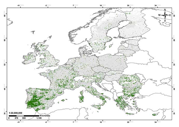
A new report examining the extent of agroforestry in Europe has just been placed on the AGFORWARD website. The report, led by Michael den Herder from the European Forest Institute, investigates the extent of agroforestry using LUCAS Land Use and Land Cover data. The Copernicus Land Monitoring Survey (high resolution maps with tree cover density) was also used to estimate tree cover on agricultural land in seven countries (Austria, Switzerland, Estonia, Latvia, Lithuania, Sweden and Norway). Both sets of results were compared with a review of the literature and statistical inventories.
The report (updated in August 2016) uses the LUCAS database to estimate that the total area under agroforestry in the EU27 is 15.4 million ha, which is equivalent to about 3.6% of the territorial area or 8.8% of the utilised agricultural area. This area is higher than the area of 10.6 million hectare derived from a recent literature review. The report can be accessed through the following website.